
Persistent Wide-Area Surveillance
Continuous day-night monitoring using electro-optical, IR, and RF payloads, overcoming satellite revisit and UAV endurance limitations.
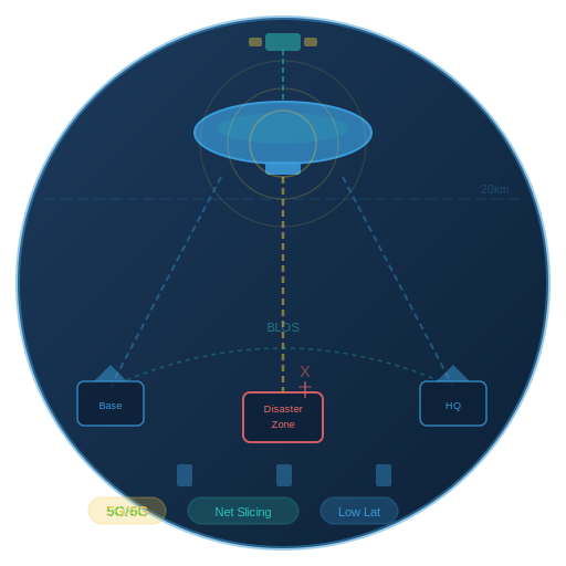
Airborne Communication Backbone
High-altitude relay for resilient, low-latency 5G/6G connectivity, network slicing, and BLOS operations in denied or disaster-hit regions.
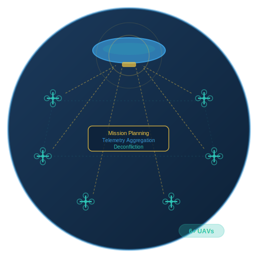
Drone Swarm Command-and-Control
Centralized aerial node for coordinating large UAV fleets, enabling real-time mission planning, telemetry aggregation, and airspace deconfliction.
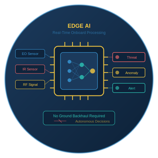
Edge AI & Onboard Analytics
Real-time processing of sensor data for threat detection, anomaly identification, and automated alerts without reliance on ground backhaul.
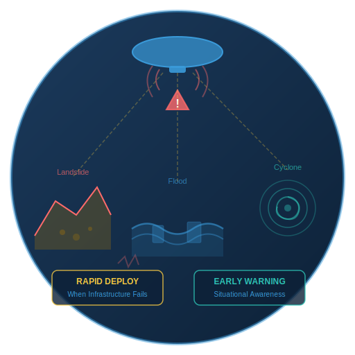
Disaster Response & Early Warning
Rapid deployment for landslides, floods, earthquakes, and cyclones — providing situational awareness when terrestrial infrastructure is compromised.
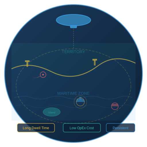
Border & Maritime Domain Awareness
Persistent intelligence for border regions, island territories, and maritime zones with long dwell times and reduced operational cost.
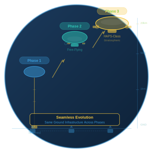
Scalable Multi-Phase Architecture
Seamless evolution from tethered aerostat systems to stratospheric HAPS-class platforms without redesigning ground infrastructure.
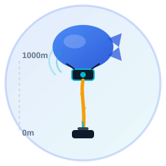
Phase 1: Tethered Aerostat
Tethered aerostat at 800–1000 m altitude for surveillance, communications relay, and UAV coordination. Validates core sensor packages, edge AI processing, and ground station integration.

Phase 2: Extended Endurance
Extended endurance high-altitude platforms with enhanced payload capacity. Solar power systems, autonomous station-keeping, and extended-duration flight testing.
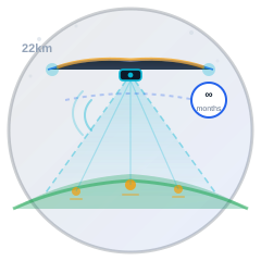
Phase 3: Stratospheric Operations
Free-floating stratospheric operations at 18–22 km for continental-scale coverage. Full HAPS capability with solar-electric propulsion and multi-month endurance.

Defense & Border Security
Persistent surveillance of international borders, LAC/LOC monitoring, and forward area intelligence without vulnerability to ground-based threats.
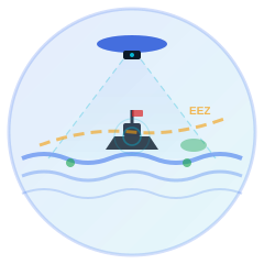
Maritime Domain Awareness
Continuous monitoring of EEZ, island territories, and shipping lanes for security, fisheries enforcement, and search & rescue.
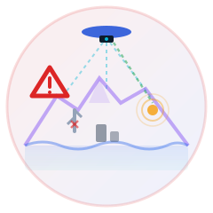
Disaster Management
Rapid-deployment communications and surveillance after earthquakes, floods, cyclones, and landslides when ground infrastructure fails.
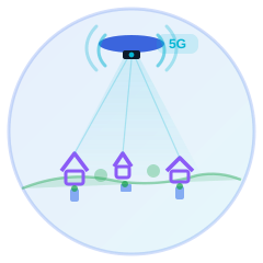
Rural Connectivity
Airborne 5G/6G backbone for remote and underserved areas, bridging the digital divide without costly ground infrastructure.

Infrastructure Monitoring
Wide-area surveillance of pipelines, power grids, railways, and highway corridors for anomaly detection and maintenance planning.
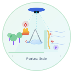
Environmental Monitoring
Forest fire detection, glacial lake monitoring, coastal erosion tracking, and pollution source identification at regional scale.