Terralux
Geospatial AI • Landslide Intelligence
AI-powered terrain analytics and early warning systems for landslide-prone regions. Precision risk mapping through advanced geospatial intelligence.
The Problem TerraLux Solves
India faces severe landslide risk with 147 vulnerable districts across 13 states and over 50 million people exposed. The 2024 Wayanad disaster claimed more than 200 lives and destroyed 2,000+ homes. Current models fail to correctly identify 30% of high-risk zones, leave 19% of at-risk population unprotected, and cause 15% of mitigation budgets to be misallocated.
147
Vulnerable Districts
50M+
People Exposed
30%
Current Model Failure Rate
What Makes TerraLux Different

Physics-Informed Feature Engineering
Computes 250+ indicators including slope, aspect, curvature, topographic wetness index, and spectral vegetation indices using geomorphological and geotechnical analysis.

Object-Based Image Analysis (OBIA)
Analyzes meaningful landscape segments rather than individual pixels, capturing real-world terrain patterns with superior performance over pixel-based approaches.

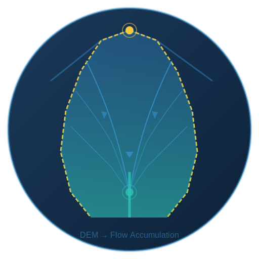
Watershed Segmentation
Advanced DEM processing, flow accumulation, and catchment boundary delineation providing natural hydrological units for landslide susceptibility analysis.

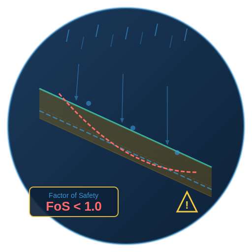
Physics-Based Slope Stability (TRIGRS)
Rainfall infiltration simulation, pore pressure rise, and dynamic material modeling. Calculates Factor of Safety (FoS) — when FoS drops below 1.0, failure is imminent.

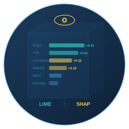
Explainable AI (Glass Box)
Uses LIME and SHAP frameworks to identify contributing risk drivers — not just risk scores but transparent, actionable intelligence stakeholders can trust.

Spatial Cross-Validation
Eliminates data leakage — a critical flaw in conventional approaches — ensuring models learn transferable patterns, not location-specific memorization.

Dynamic Material Modeling
Real-time precipitation and Sentinel-1 SAR moisture proxy data drive cohesion reduction, friction angle adjustment, and unit weight changes. Up to 30% strength loss at full saturation.

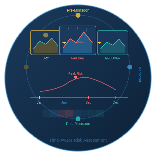
Spatio-Temporal Segmentation
Captures seasonal terrain dynamics from pre-monsoon degradation to monsoon-triggered failures for time-aware risk assessment.

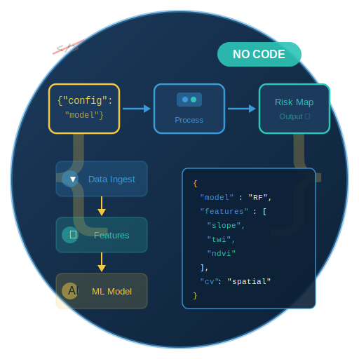
No-Code JSON Pipeline
JSON-driven pipeline enabling non-experts to deploy production-grade models with scientific rigor. No coding required.
Multi-Source Intelligence Fusion
TerraLux integrates seven distinct data streams into a unified analytical framework.

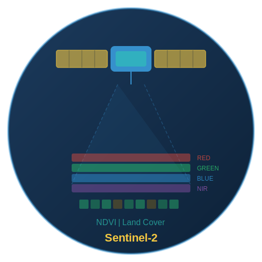
Sentinel-2 Optical Imagery
Multi-spectral optical data for vegetation indices, land cover, and surface characterization.
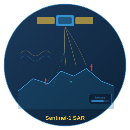
Sentinel-1 SAR Data
Synthetic Aperture Radar for all-weather surface deformation and moisture proxy detection.

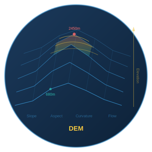
Digital Elevation Models (DEM)
High-resolution terrain data for slope, aspect, curvature, and flow accumulation analysis.
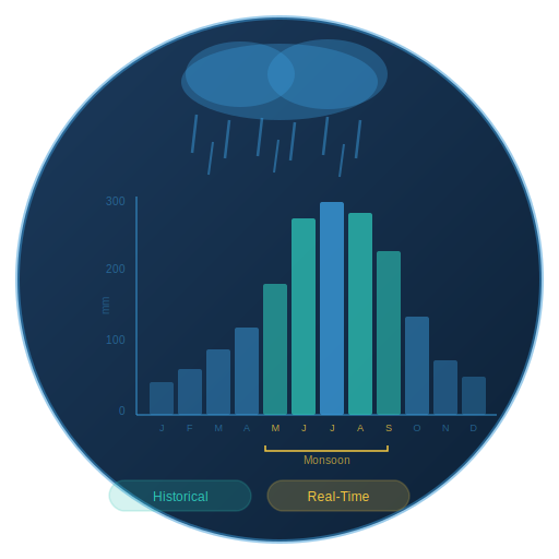
Rainfall Datasets
Historical and real-time precipitation data for infiltration modeling and trigger analysis.

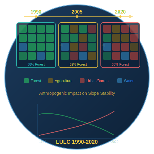
Land Use Land Cover (1990–2020)
Three decades of LULC change data to assess anthropogenic impact on slope stability.
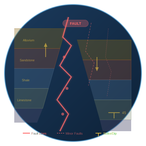
Structural Geology
Fault lines, lithology, and geological discontinuities influencing slope behavior.
Who Uses TerraLux
State Disaster Management
Early warning systems, resource pre-positioning, and evacuation planning for disaster management authorities.
District Administration
Granular risk maps for land use planning, building permits, and infrastructure prioritization.
Infrastructure Planning
Route optimization for railways, highways, and pipelines through landslide-prone terrain.
Urban Development
Safe zoning recommendations for hillside construction and expanding urban peripheries.
Environmental Conservation
Ecologically sensitive zone identification and conservation area boundary delineation.
Mining & Resources
Slope stability assessment for mining operations and quarry site selection.
Defense & Security
Terrain intelligence for military route planning and forward operating base siting.
Insurance & Risk Assessment
Geo-risk scoring for property insurance underwriting and portfolio risk management.
India-First Design
Purpose-built for Himalayan geology, Western Ghats topography, and monsoon rainfall patterns. Aligned with government datasets and operational realities. Architecture is transferable to landslide-prone regions across South Asia, Southeast Asia, and East Africa.
What Changes with TerraLux
Before
TerraLux
- 6–12 months for manual susceptibility mapping
- 30% high-risk zones misidentified
- 15% of mitigation budgets misallocated
- 19% at-risk population unprotected
- Pixel-based analysis missing terrain context
After
TerraLux
- Full pipeline in ~2 weeks
- 60–70% cost reduction
- 250+ physics-informed indicators
- Explainable, auditable risk scores
- Object-based terrain intelligence
